Most of the world’s smallest nations are either island states amidst the Pacific Ocean or Caribbean Sea, or tiny countries landlocked in Europe. From street-sized to giant town-sized, these 13 smallest countries in the world are all under 400 sq. km. and combined area of 3226.51 sq. km. Each holds independence close to heart, and with many dependent on tourism, offer a whirl of emotions and unique sights to easily explore and never forget.
The 15 Smallest Countries in the World
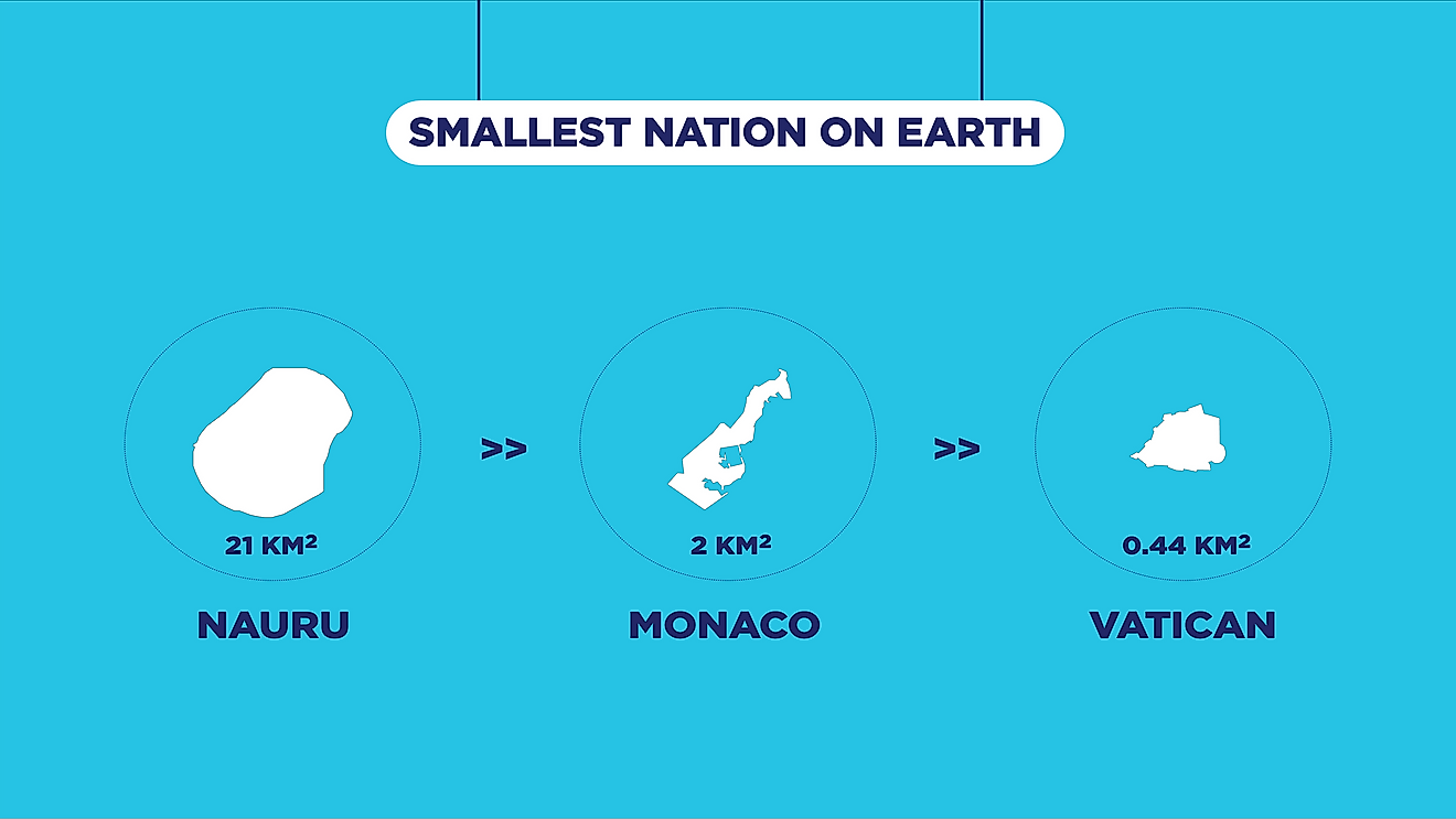
- Vatican City – 0.44 km2 (0.17 mi2)
- Monaco – 2.02 km2 (0.78 mi2)
- Nauru – 21 km2 (8.1 mi2)
- Tuvalu – 26 km2 (10 mi2)
- San Marino – 61 km2 (24 mi2)
- Liechtenstein – 160 km2 (52 mi2)
- Marshall Islands – 181 km2 (70 mi2)
- Saint Kitts & Nevis – 261 km2 (101 mi2)
- Maldives – 298 km2 (115 mi2)
- Malta – 316 km2 (122 mi2)
- Grenada – 344 km2 (133 mi2)
- St Vincent & the Grenadines – 389 km2 (150 mi2)
- Barbados – 431 km2 (166 mi2)
- Antigua and Barbuda – 443 km2 (171 mi2)
- Seychelles – 455 km2 (176 mi2)
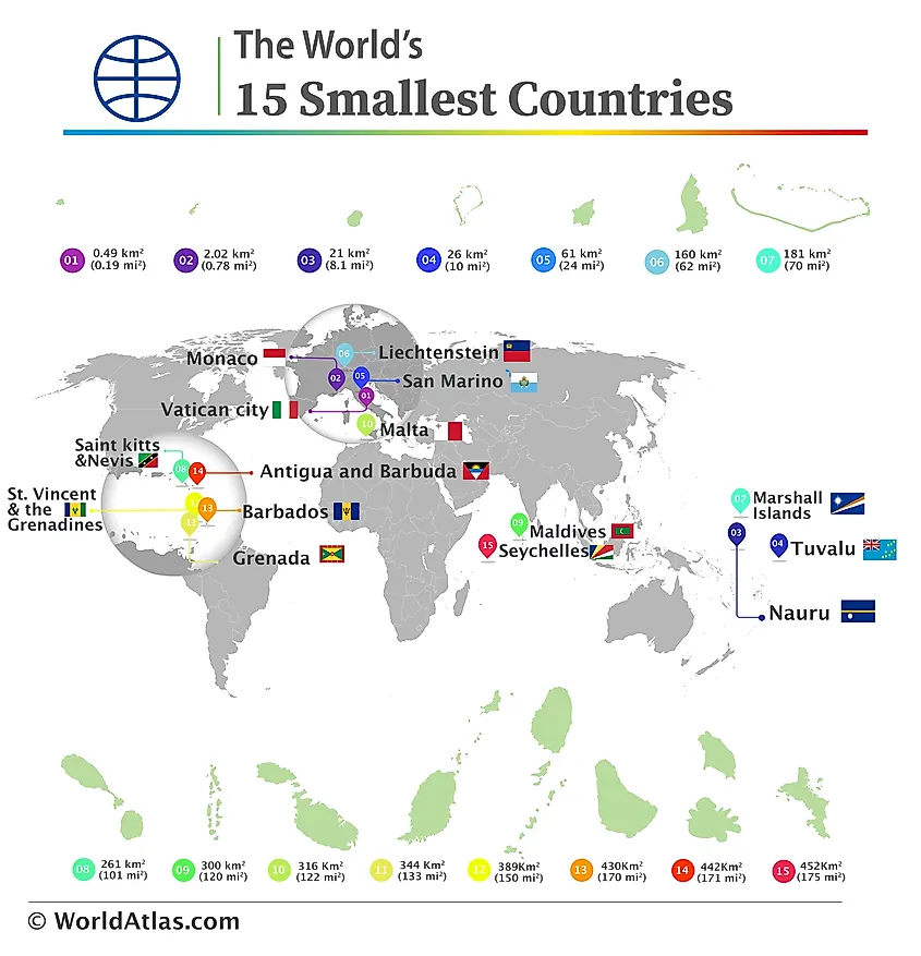 The locations of the 15 smallest countries in the world, with their areas depicted according to scale
1. Vatican City – 0.44 km2 (0.17 mi2)
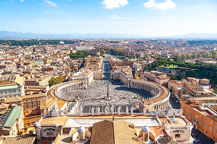 View from the Cupola of St Peter’s Basilica in the Vatican
The tiniest country is just an enclave of the Italiaanse city of Rome. Vatican City is also the smallest monarchy in the world, with head of state, His Holiness the Pope, as well as the smallest city-state with no capital of its own. The history of Vatican City dates back to the 4th century when Theodosius I made Christianity the official state religion of the Roman Empire.
On February 11, 1929, the Lateran Treaty was signed by Italy and the Holy See, establishing Vatican City as an independent state in 1929. Since then, it has been an independent city-state under Papal control. The landlocked sovereign country covers an area of 0.49 square kilometers with population of just over 500 and density of around 1,000 per sq. km. The State of Vatican City is the territory of the Holy See (Sancta Sedes), the headquarters of the Roman Catholic Church, as well as the seat of the episcopal jurisdiction and the Catholic Church’s central government.
2. Monaco – 2.02 km2 (0.78 mi2)
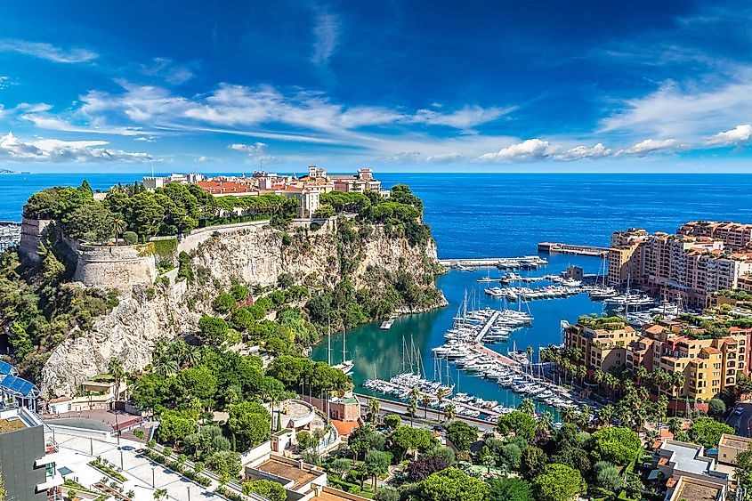 Panoramic view of prince’s palace in Monte Carlo in a summer day in Monaco
The second-smallest country is Monaco, covering 2,02 square kilometers with a population of 36,365 and density of 18,161 people per square kilometer. Call it principality or state, the smallest country with its beautiful coastline is just an enclave along the southeast coast of France, the French Riviera. It is known for the city of Monte Carlo which is full of casinos and resorts for the rich like the Monte Carlo Rally, the Monaco Grand Prix, and the Monte Carlo Casino. Founded in 1215, the Grimaldi family has been ruling over Monaco since 1331, making it one of the world’s oldest ruling dynasties. The country is mostly characterized by its hilly terrain, especially along its coastline.
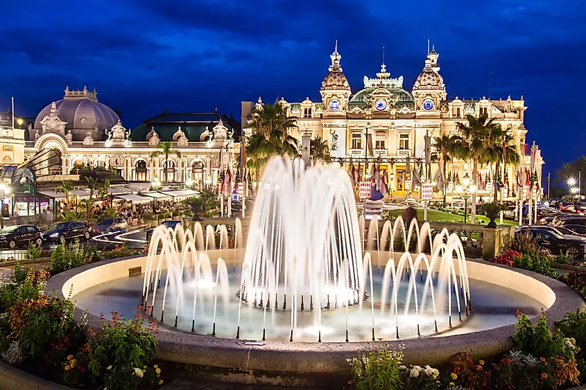 The Monte Carlo Casino, gambling and entertainment complex in Monte Carlo, Monaco
The city state with no capital boasts world’s largest police force per capita, is nicknamed “Billionaires’ Playground” due to having one of the world’s highest GDP/capita indicators. It is also the smallest member state of the United Nations, and the world’s most-densely populated sovereign country. Monaco is set 9 miles from the beautiful French city of Nice, and five miles away from France’s border with Italy. Monaco is a tax heaven with mild climate that draws visitors especially millionaires on an expensive vacations.
3. Nauru – 21 km2 (8.1 mi2)
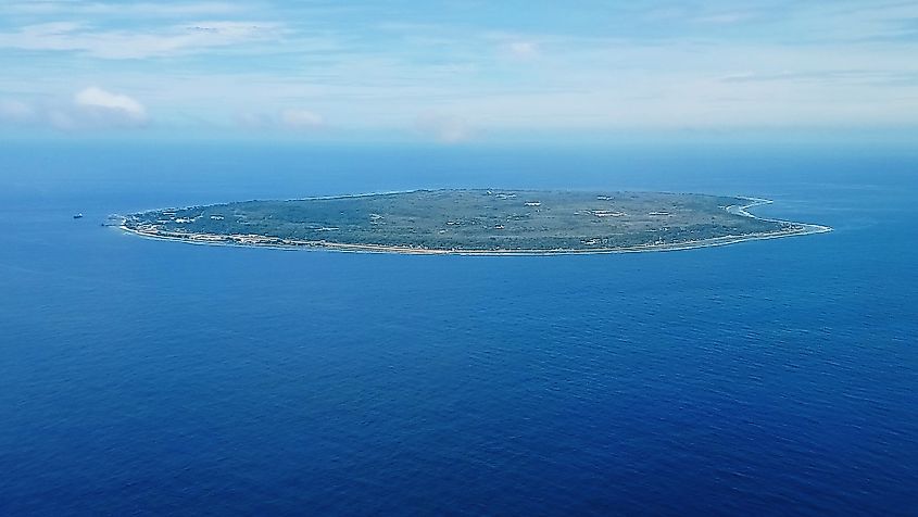 Aerial view of Nauru
Formerly known as “Pleasant Island,” Nauru is the world’s third smallest island-state with one of its roads being nineteen-kilometers long, circling around the island. Nauru makes a notable leap from the street-sized countries above with an area of 21 square kilometers. It is home to some 12,700 residents and has a population density of 592.94 people per sq. km. Nauru is the host to world-renowned airport and runways along a beach, a tourist-destination in its own right for thrills. Nauru has a relatively recent history as an independent state, gaining recognition from Australia and New Zealand in 1968. The terrain of Nauru is mostly limestone covered with white sand deposits and surrounded by coral reefs.
 A beachside in Nauru
The Micronesia island is the world’s smallest republic. It is located just northeast of Australia, relying on the Land Down Under for imports. Nauru has very-few resources of its own, while in 2001, the republic signed an agreement with Australia to accept over 1,000 asylum seekers for millions of dollars in aid.
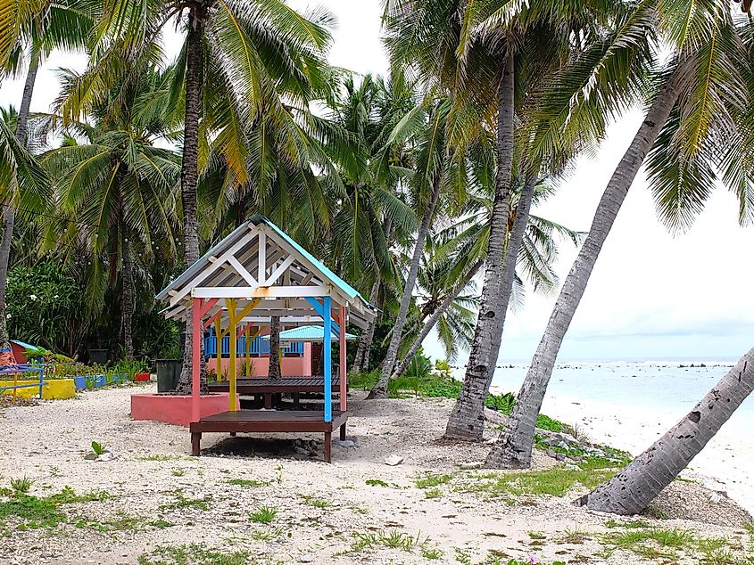
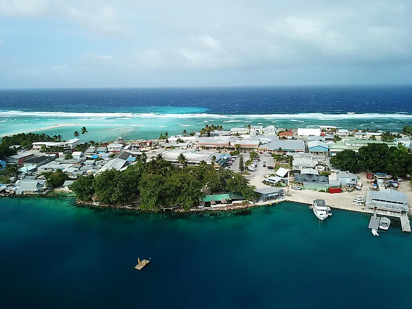
4. Tuvalu – 26 km2 (10 mi2)
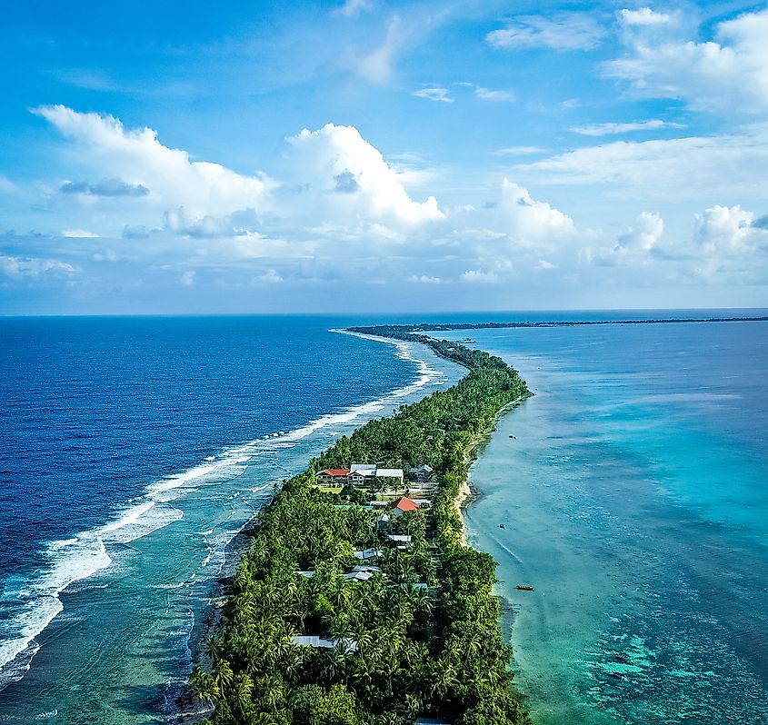 Aerial view of the island of Tuvalu
Like the island above, Tuvalu has very little resources, traditionally relying on tourism services like selling stamps and renting out fishing areas, while living on development aid. The tiny nation was blessed with luck in 2000, when “.tv” was released for $50 million. The royalties from the American company VeriSign for appealing internet top-level domain for the next twelve years suddenly made the small island, rich.
Tuvalu consists of four reef islands and five atolls. Indigenous Polynesian peoples have inhabited Tuvalu for centuries. In 1974, they received independence from Britain and became a self-governing state within the Commonwealth Realm. The terrain of Tuvalu is mostly flat with several raised coral limestone formations in the northern part of the island. The highest point on the island is only a few meters above sea level. Despite this, low-lying coral reefs form much of its protective perimeter, making it vulnerable to threats such as rising sea levels caused by climate change.
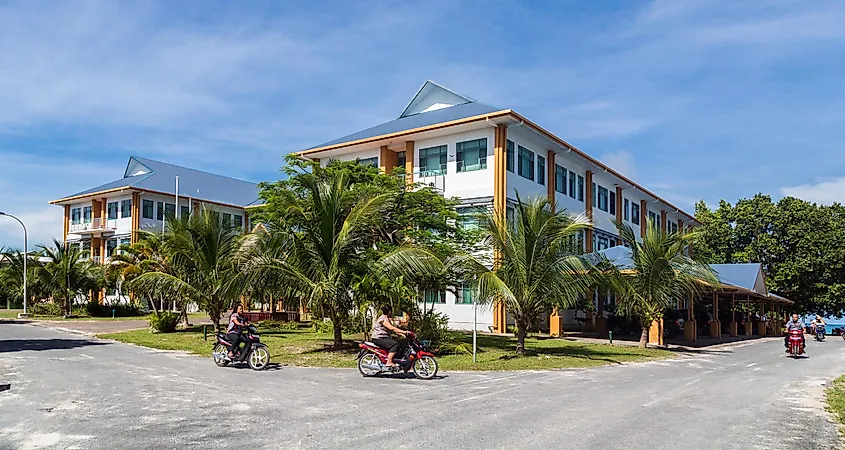 The largest and tallest, only three-story building in Tuvalu
Tuvalu is a Polynesian archipelago of nine main islands in the South Pacific, or sixteen reef islands under constitutional monarchy. The island nation, formerly known as the Ellice Islands, covers 26 square miles with a population of around 11,350 and density of 430.92 people per sq. km. It is part of the Central Pacific Ocean just below the equator with Fiji to the south and western neighbors of the Solomon Islands.
5. San Marino – 61 km2 (24 mi2)
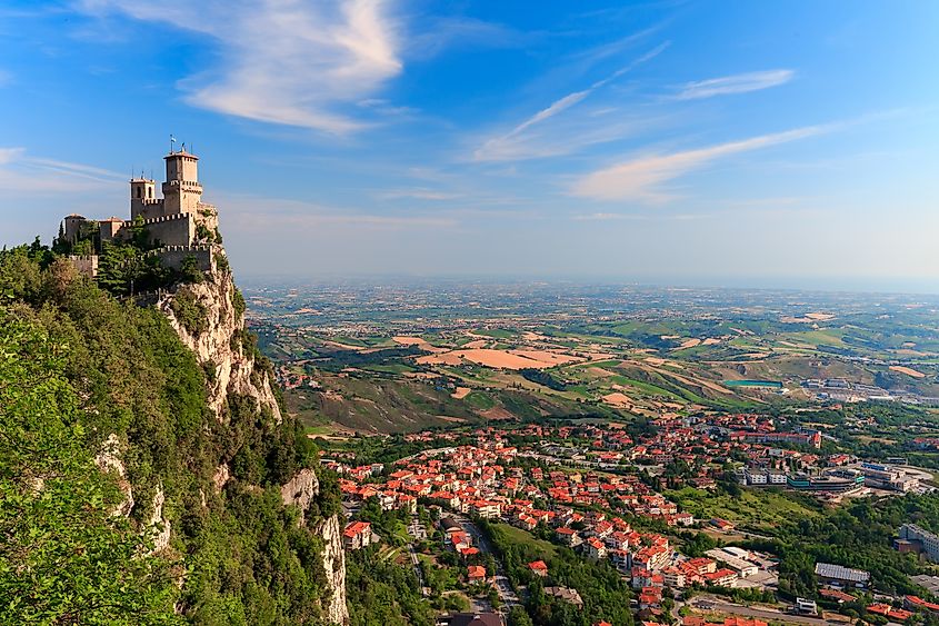 Aerial view of San Marino
San Marino sits engulfed within the Italian region of Emilia-Romagna, in northeastern Italy, part of the country’s Apennines region, comprising a great day-trip from Rimini. The capital San Marino Città is a sight to see with high medieval fortress walls around and a beautiful, large castle with three high defensive towers open for visitors. The nation state celebrates vibrant Middle Ages themed festivals that often have a backdrop capable of transporting one right back in time.
San Marino is one of five European microstates and is classified as the oldest European republic, dating back to 301 AD, and constitution dating back to 1600. San Marino has had a turbulent history, being invaded and occupied by multiple foreign powers since its foundation. The terrain of San Marino is mountainous, with Monte Titano being its highest peak at 2,425 feet above sea level. It is surrounded by rugged hills, lush forests and an abundance of historic medieval castles.
San Marino also shares its borders with Italy to the north and east while the Adriatic Sea lies to its southeast. The small country spreads an area of 61 square kilometers and population today comprises 33,650 for density of 550 people per sq. km. San Marino is the wintering destination for snowbirds, welcoming tourists with Italian language on the sunny streets and vibrant winter festivities with fun activities and large Christmas markets.
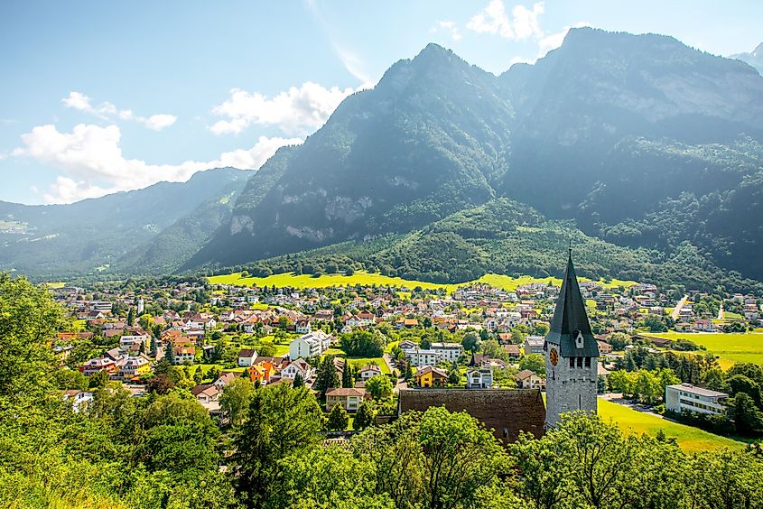
6. Liechtenstein – 160 km2 (52 mi2)
 Landscape view of Balzers village with saint Nicholas church in Liechtenstein
The micro-state in Europe takes a leap in size comprising 160 square kilometers principality with 39,475 residents and population density of 243 people per sq. km. Lichtenstein neighbors Switzerland to the west and south and Austria in the east. Its capital city is Vaduz and German is the main language, while 34% of the inhabitants are foreigners. The state is most-known for mountainous terrain with many winter sport resorts and tax haven attracting the active wealth. The country’s economy depends on international companies that in-turn benefit from Liechtenstein’s low taxes.
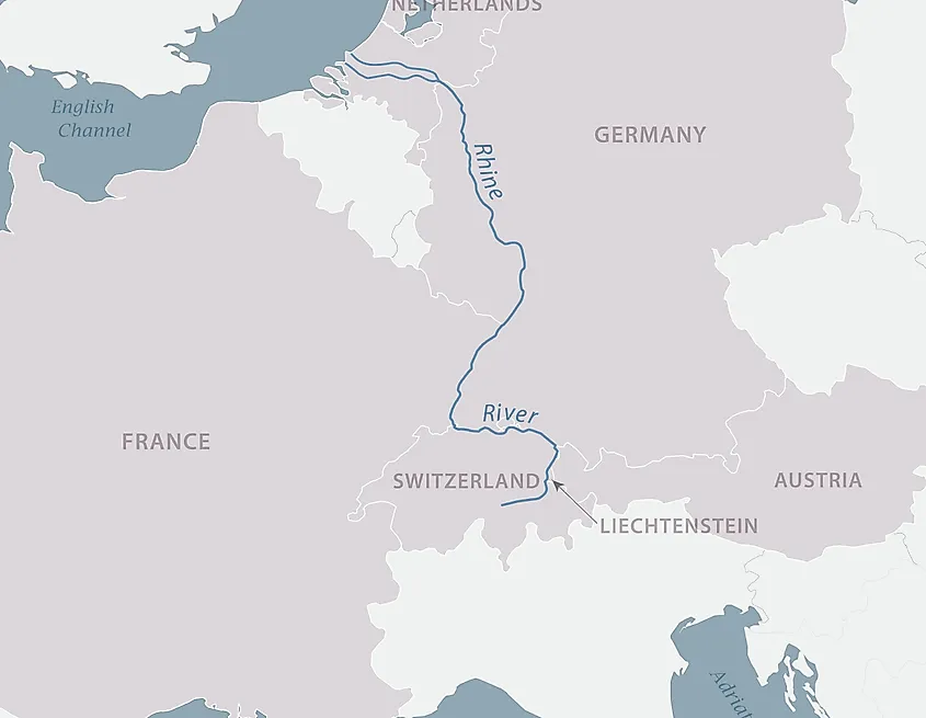 The Rhine River separating Liechtenstein from Switzerland
The earliest inhabitants of Liechtenstein were probably Celtic tribes who settled in the region around 500 BCE. The Roman Empire annexed the area in 15 BCE, but it later became a principality within the Holy Roman Empire in 1719 CE. Liechtenstein’s terrain is mostly mountainous, with the Alps occupying most of the country. There are also several valleys and rivers, including the Rhine River, which forms part of Liechtenstein’s border with Switzerland.
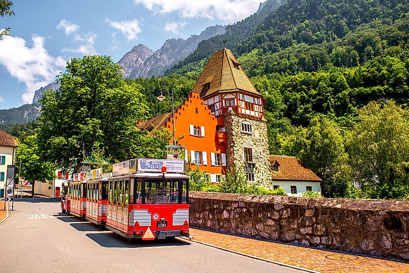 People on the tourist train visit famous red house with wineyard in Vaduz city in Liechtenstein
The Prince of Liechtenstein and a democratically elected parliament share the power over the tiny landlocked principality with the Prince, Hans-Adam II, in power since 1987. Adrian Hasler is the current Prime Minister, from the center-right Progressive Citizens Party. The country gained independence from German Confederation in 1866 forming a toll union with Austria. Its ties with Switzerland grew stronger since 1918 with a customs union concluded between the two in 1923. They signed the Schengen Agreement to abolish mutual border controls, and like Switzerland, Liechtenstein is not cheap nor part of the European Union.
7. Marshall Islands – 181 km2 (70 mi2)
 Aerial view of Majuro, the capital of the Marshall Islands
The Republic of the Marshall Islands comprises 1156 volcanic islands and coral atolls within the North Pacific Ocean, covering an area of 181 km sq. The country’s falling population comprises around 41,800 with density of 231.78 people per sq. km. It is a protection hub for a large population of sharks within a sanctuary spreading the ocean for about two million square kilometers around.
 Aerial view of the Marshall Islands, located in the Pacific Ocean
The Marshall Islands is a former US territory, now independent state between Hawaii and the Philippines with great weather that many tourists seek on a remote respite. The islands are bounded by white, sandy beaches and waters housing coral reefs. Out of the thirty inhabited atolls, Bikini is famous for nuclear American tests after World War II that forced the entire population to emigrate to another atoll. The radiation levels dropped to a normal range and Bikini continues attracting divers for the surrounding fleet of 27 sunken ships from the Second World War.
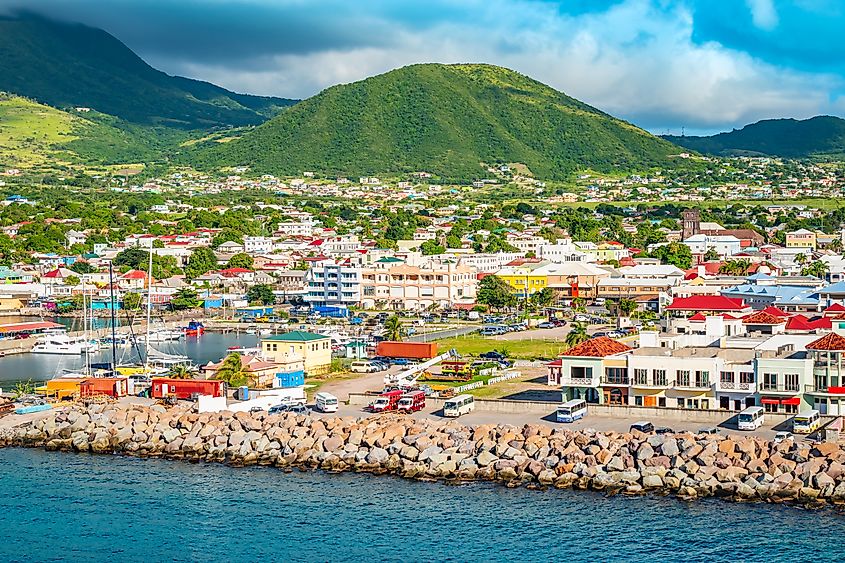
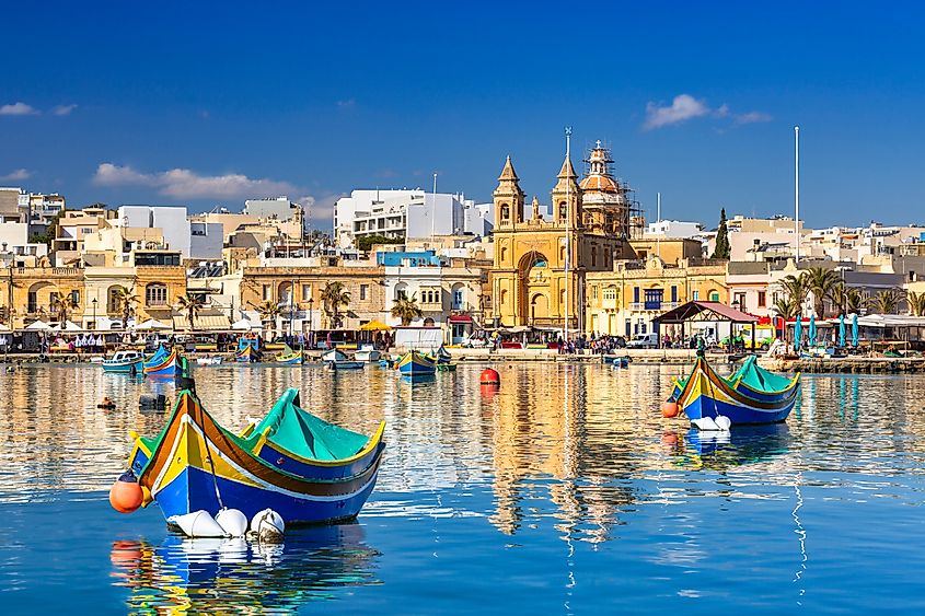
8. Saint Kitts & Nevis – 261 km2 (101 mi2)
 Basseterre, Saint Kitts and Nevis
The two volcanic islands comprising America’s smallest sovereign state are part of the Leeward Islands in the eastern Caribbean Sea, with an area of 261 square miles. It is a federal constitutional monarchy with a population of about 47,700 residents and English as official language. Saint Kitts and Nevis are a popular tourist destination, also known as Saint Christopher and Nevis. Before turning to tourism, large sugarcane cultivation was central to the economy. Nevis is known as a love island, a destination for married couples.
The Islands were originally inhabited by Kalinago Indians until European settlers arrived in 1623 and founded the first British colony in the region. Since then it has gone through years of slavery, plantation farming and colonial rule. In 1983, Saint Kitts & Nevis was granted full independence from Britain. Today it is an independent nation with a stable political system as well as vibrant culture and economy.
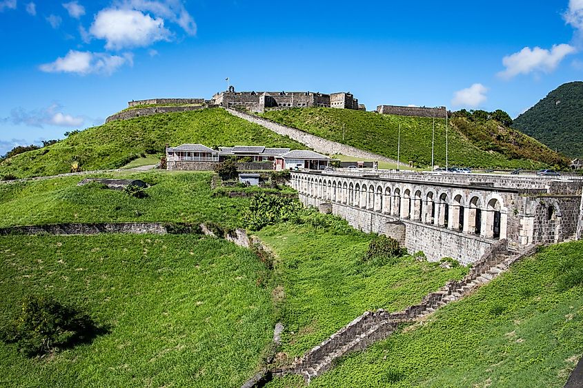 Brimstone Hill Fortress National Park, Saint Kitts and Nevis in the Caribbean
Kitts is relatively untouched with more culture to see. The Kittitians are a mix of Caribbean and British influences, living in a white-sanded palm-laden beach paradise bounded by the blazing blue ocean. The pristine scape with coconut palm trees attracts newlyweds and young couples, while the inland areas house volcanoes, mountains and canyons. Although the islands are fairly undiscovered, there are idyllic hotels with dream accommodations, as well as an annual swimming competition between the islands.
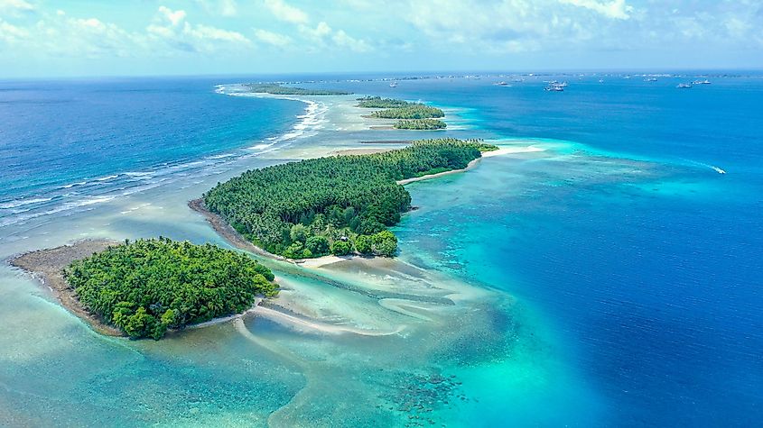
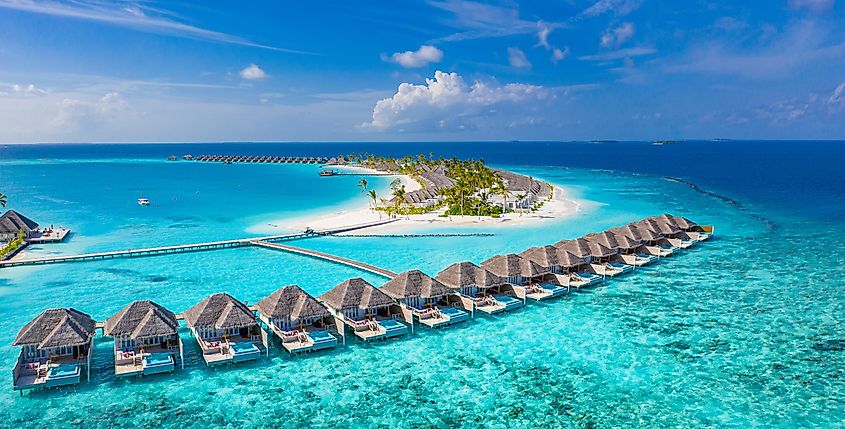
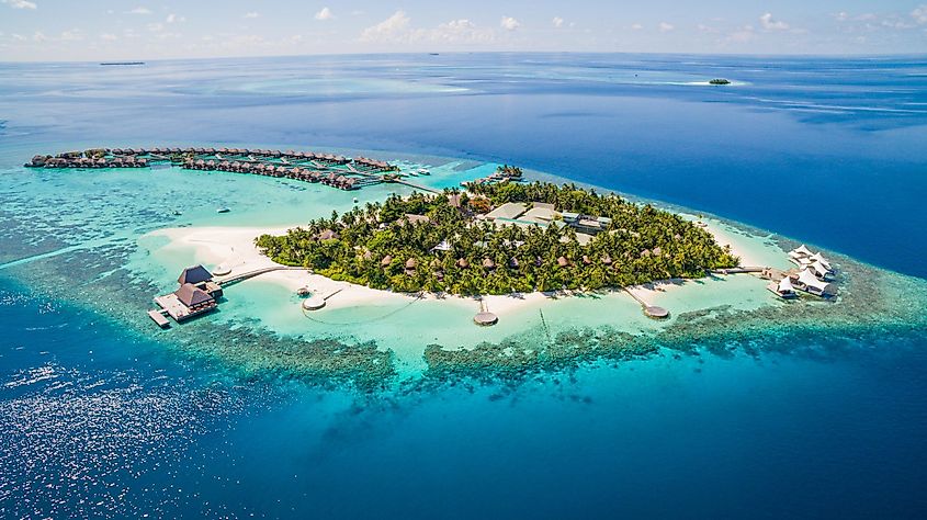
9. Maldives – 298 km2 (115 mi2)
 Aerial view of the Maldives
The independent state consists of two chains of twenty-six atolls in the Indian Ocean with an area of 300 square kilometers. The Maldives are home to around 522,500 people, with the largest Male Atoll and namesake capital largest city, divided into northern and southern parts. The Raa Atoll and Baa Atoll have beautiful, dense vegetation and pristine diving areas around.
The Maldives’ landscape consists of white sandy beaches, crystal clear waters and abundant coral reefs which make it ideal for snorkeling and diving. Its history dates back to the 2nd century BCE when Buddhism was introduced by seafarers from India. In 1558, the country fell under Portuguese rule followed by British colonization in 1887. After gaining independence in 1965, the country has developed into a democracy with a successful economy based on fishing and tourism.
 Beautiful greenery pictured using a drone in the Maldives
The “Maldives” translating to “island chain,” is quite poor with relatively cheap services. There are also strict rules separating locals from tourists, and beach-wear regulations. One can still observe the daily culture regularly, with most islanders living-off tourism. There are many beautiful hotels, while the islands’ span across the equator lends lovely weather for anytime visit. There are beautiful beaches, resorts, and unique culture of the Islamic State with Maldivian as the main language.
10. Malta – 316 km2 (122 mi2)
 Traditional fishing boats in the Mediterranean Village of Marsaxlokk, Malta
Malta is an archipelago located in the Mediterranean Sea and composed of three main islands. Its landscape is characterized by high hills and terraced fields, as well as numerous bays, harbours, and beaches. Evidence of human settlement on the islands dates back to around 5200 BCE. The small country of 216 sq. km. in area is a popular cultural destination with rich history and prehistoric buildings, like the megalithic temples of Tarxien and the Mnajdra and Hagar Qim temples. The latter was built during a unique era to function like a clock. Malta has always been a strategically important place, as well as scene of battles among its conquerors. It was ruled by several nations over years, with all leaving a cultural mark, before final independence from Britain.
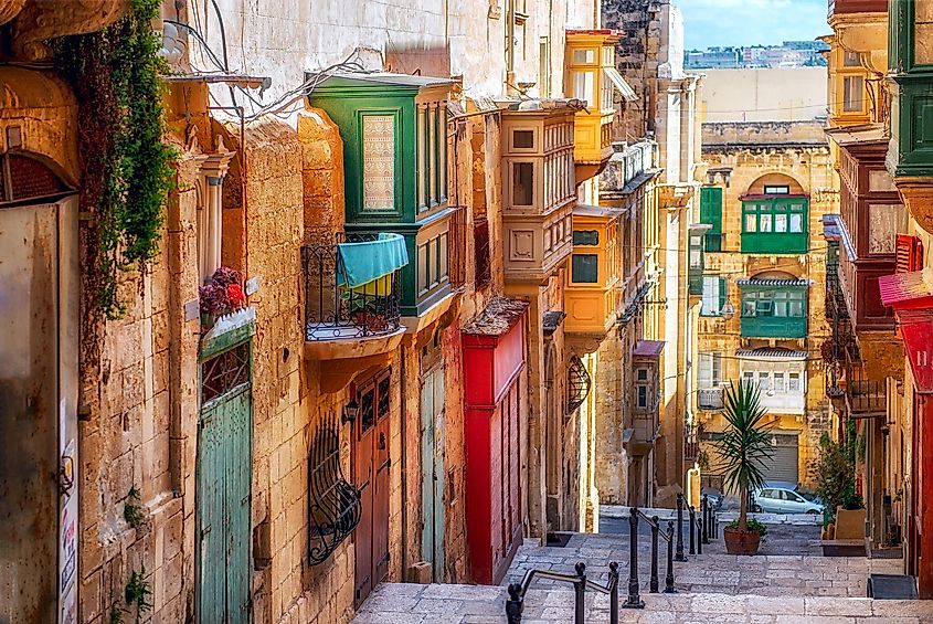 Narrow street in Valletta – the capital of Malta.
The mix of heritage is evident in the mishmash finds of developed dishes, sports, and architectural styles and festivals. Malta is the world’s most populous sovereign state with 534,300 people, of mainly Italian, British and Moorish descents with relevant influences around the streets. Malta is the largest of three islands including Gozo, and Comino in the Mediterranean Sea, south of Sicily. The beaches under warm climate attract many tourists, along with reasonably-priced services, and popular appearances in major movies like “Game of Thrones” and “Gladiator.”
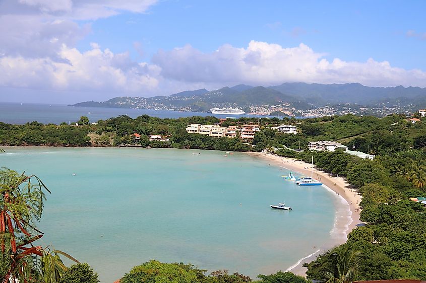
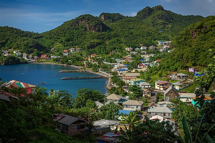
11. Grenada – 344 km2 (133 mi2)
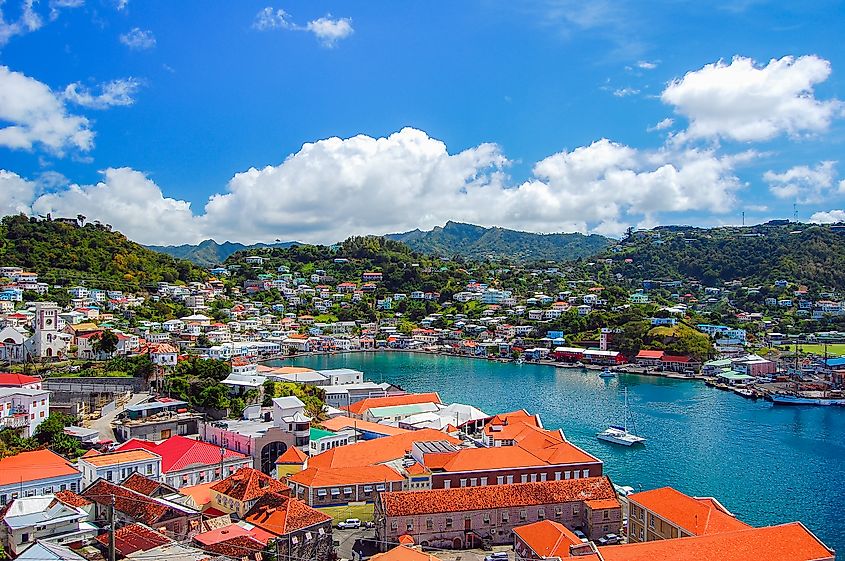 The town of Saint George, capital of Grenada
This constitutional monarchy of six islands spreads over 344 square kilometers in the West Indies, right above Trinidad and Tobago. Grenada is the largest island and most populated of the archipelago known as the Lesser Grenadines in the Caribbean Sea. The volcanic islands feature extremely fertile soils, flourishing agricultural trade of cinnamon, ginger, citrus fruits, coffee, and nutmeg, that appears on Grenada’s national flag.
Grenada’s landscape consists of lush rainforests, tropical beaches and an inland chain of volcanoes which gives it its unmistakable hilly terrain. The earliest recorded settlers on Grenada were Arawaks who arrived around 2,000 years ago. In 1498, Christopher Columbus claimed the island for Spain. Later on, Grenada was colonized by Britain in 1783 and remained under their rule until 1974 when it gained independence from Britain and became a member of the Commonwealth of Nations. Today, Grenada is famous for its diverse wildlife and stunning landscapes as well as its cultural heritage and rich history.
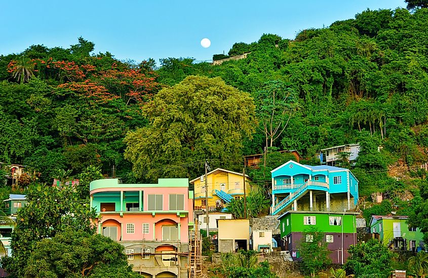
 Morne Rouge beach in Grenada
The “Spice Island” is a popular destination for diving, snorkeling, swimming, and sailing in a remote setting, along with inland natural parks, and eight smaller islands around. The local population of nearly 126,000 consists of eighty percent slave descendants with rich cultural and historical offerings like sports and festive carnivals. St. George is the capital, largest city, while English is the official language, along with Grenadian Creole English and Grenadian Creole French variations.
12. St Vincent & the Grenadines – 389 km2 (150 mi2)
 View of Barrouallie with Sea and palm trees in Saint Vincent and the Grenadines
The 32 islands of St Vincent and the Grenadines spread for 389 sq. km. within the Windward Islands group of hundreds more islands. The independent state is a constitutional monarchy, home to declining populace of 103,700 and best-known for huge banana crop, the backbone of the country’s GDP. The mostly-mountainous islands surrounded by white-sanded shores and clear blue waters lend to great sailing, diving, and snorkeling. There is also wildlife and birdwatching opportunities, including tropical specie, whales and dolphins. The terrain of the islands is mountainous and volcanic, creating stunning views for visitors.
The first inhabitants of St Vincent & the Grenadines were the Carib people and Arawak tribes who migrated from South America. The British colonizers arrived in the 18th century, changing the name to St Vincent and introducing slavery and eventually abolishing it in 1834. Today, St Vincent & the Grenadines is famous for its turquoise bays with white sand beaches, tropical climate and friendly locals as well as its delicious cuisine.
 Kingstown colorful houses on the hill in Saint Vincent and the Grenadines.
Saint Vincent is the main island with short streams, thick woods, a volcano, several waterfalls, and a saltwater lake. It is home to the capital city of Kingstown, along with other major towns under a tropical maritime climate. The smaller islands of the Grenadines are Petit Mustique island, Savan Island, Petit Canouan, Canouan, Mayreau, Tobago Cays, Union Island, Bequia, Baliceaux island, Mustique, and Petit St. Vincent Island. The state gained independence from the United Kingdom, now part of the British Commonwealth of Nations.
13. Barbados – 431 km2 (166 mi2)
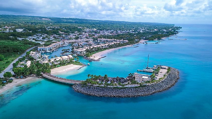 Luxury Places on the Coastline of Barbados Island, Caribbean Paradise
The Eastern Caribbean country is the 13th smallest independent state in the world spreading over an area of 430 square kilometers. Barbados is the easternmost island of the Lesser Antilles archipelago in the Atlantic, just off the coast of Venezuela and Guyana, and most-visited by tourists in the Caribbean. The thought-after destination encompasses a real paradise with beautiful weather under nearly-constant sunshine.
The terrain is mostly hilly and rugged, featuring beautiful beaches, caves and coral reefs. Barbados was first inhabited by the indigenous Arawak and Carib peoples before it became a British colony in 1627. Following independence from Britain in 1966, Barbados developed a thriving tourist industry as well as a successful agricultural sector. Today, Barbados is known for its diverse culture, colonial architecture, and world-renowned beaches.
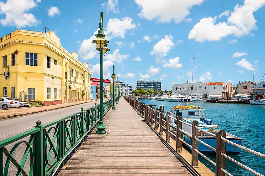 Walkway at marina of Bridgetown, Barbados
Barbados is a constitutional monarchy with a coastal capital city of Bridgetown on the southwest side. It is the largest town and main seaport, with many stunning resorts around. The nation’s population of some 281,800 of mostly African descent and African-European descent is the wealthiest and most developed in the Eastern Caribbean.
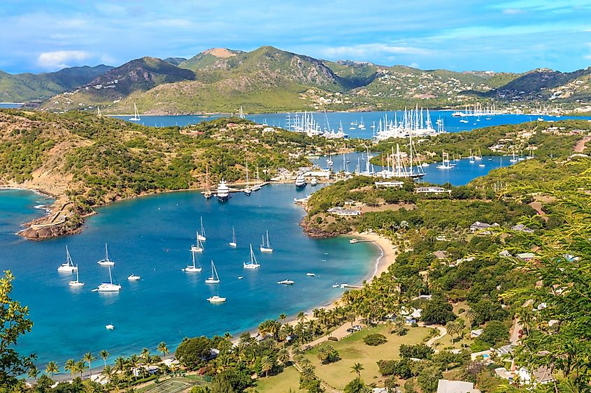
14. Antigua and Barbuda – 443 km2 (171 mi2)
 Antigua Bay, view from Shirely Heights
Covering an area of only 440 sq. km, the dual-island nation of Antigua and Barbuda is in the Caribbean Sea. Located where the Atlantic Ocean meets the Lesser Antilles, the terrain of both islands is generally hilly, covered in lush vegetation and dotted with golden sand beaches. The history of the islands dates back to pre-Columbian times when it was inhabited by Arawak or Ciboney peoples. Antigua was colonized first by British interests in 1632 while Barbuda only had permanent settlement as a result of recruiting free African slaves and former enslaved Africans from surrounding Caribbean Islands. Since obtaining its independence from Britain in 1981, Antigua and Barbuda has become one of the most prosperous nations in the region, boasting excellent tourist infrastructure and a stable government.
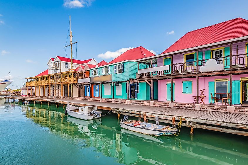 St. John’s City, Antigua
Both islands are relatively low-lying limestone formations, are ringed by reefs and sandbars, and indented by small lagoons and natural harbors. The highest point is Mount Obama (formerly Boggy Peak), which is located in the hilly region of southwestern Antigua; it is a remnant of a volcanic crater that rises to 405m. There are no rivers of note and only a few streams are present, as rainfall amounts are quite light. Situated about 63km north of Antigua Island is Barbuda – which is mainly a flat and tree-covered coral island. The highest elevation is 44.5 m (146 ft), and a part of the highland plateau on the eastern edge of the island. The most noteworthy landform of Barbuda’s coastline is the Codrington Bay natural lagoon on the western side of the island.
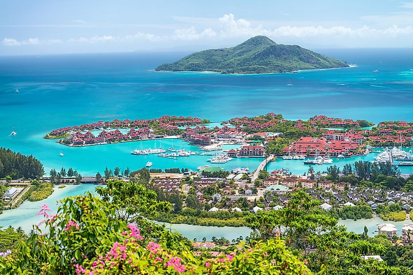
15. Seychelles – 455 km2 (176 mi2)
 Red roofs of Eden Island, aerial view of Seychelles
Seychelles is a small island republic within the western Indian Ocean, comprising 455 sq. km of land over about 115 islands. It is an atmospheric paradise proximate to the equator with under 100,000 residents, tropical vegetation, endless beaches, and wide specter of marine life. One of the world’s smallest countries is composed of two main island groups, the Mahé group with over 40 central, mountainous granitic islands and 70 outer, flat, coralline islands in the other group. The primary rocky islands comprise a narrow coastal strip and inland hills, some 1,000 miles (1,600 km) east of Kenya and 700 miles (1,100 km) northeast of Madagascar, with the capital city of Victoria on the Mahé island.
The terrain otherwise is mostly mountainous with rainforest-covered peaks that lead to spectacular coastlines. In terms of history, Seychelles was originally explored by French and British forces in the 18th century and then served as strategic points during WWI and WWII. Seychelles gained independence in 1976 and today is home to a vibrant culture infused with African, French, Indian and British influences.
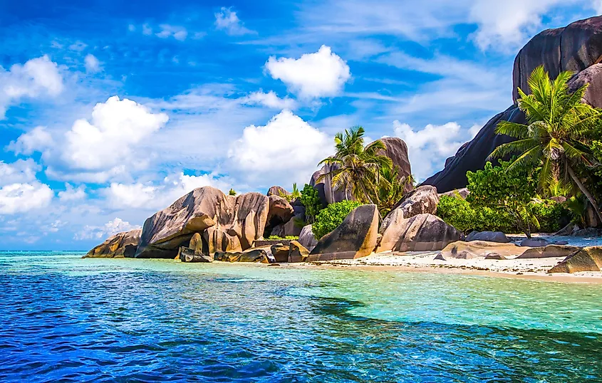 The famous beach, Source d’Argent at La Digue Island, Seychelles
The postcard islets veil high hanging gardens overlooking silver-white beaches and clear lagoons. The nation peaks at the Morne Seychello at 2,969 feet (905 meters) on Mahé. The coralline islands are only a few feet high with elevated coral reefs of all ages. There is nearly no fresh water, lending to only a few residents in population. Seychelles’ tropical oceanic climate maintains year-round pleasant temperatures with daily highs in mid-80s F (low 30s C), dropping to low 70s F (low 20s C) at night. Mahé receives about 90 inches of annual rain at sea level and up-to 140 inches in the mountains. Although islands vary in precipitation, there is high humidity all-around.
Micronations Around the World
Besides the small states mentioned above, there exist many micronations around the globe that claim sovreignity or independece but are not internationally recognized as such. These nations include: Macau, Hong Kong, The Principilaity of Sealand, and Liberland.
Macau, Hong Kong, and Taiwan
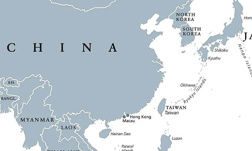 A Map showing China, Macau, Hong Kong, and Taiwan
Macau is a special adminstrative region of China, and it spains 32 km2 making it just a little larger than the island nation of Tuvalu. A former Portuguese colony, Macau is the most densely populated place in the world, having a population of 686,607 and a density of 20,870 people/km2 Hong Kong is also a special adminstrative region of China; it covers 1,104 km2 of area and is almost twice the size of the Seychelles. At the end of the Opium wars in 1841, Hong Kong was established as a British colony for some time, and was, in WW2, occupied by Japanese forces. In 1997, Hong Kong was transferred back to China, and now has a separate economic systems than China, but stands as one of the most developed places in the world. It is also worth mentioning that Taiwan is a relatively small nation that claims independence from China, a claim that is of course heavily disputed by the PRC. There are 13 countries around the world that recognize the sovereignty of Taiwan, but with the increasing pressure and assertiveness of the PRC in regards to foreign policy, this number is not likely to increase any time soon.
The Principality of Sealand
The Principality of Sealand is a micronation located on a former World War II platform in the North Sea off the coast of England and was declared as an independent state by British pirate radio broadcaster, Paddy Roy Bates, in 1967. Despite not being officially recognized by the British government, Sealand has established itself with its own government, symbols, and currency. It is only 0.004 km2 in area, making it about the size of a football field.
Liberland
Liberland is a self-proclaimed micronation founded in 2015, claiming a small piece of land on the western bank of the Danube River, an area that has been disputed by Croatia and Serbia. It bills itself as a free and sovereign state with a focus on individual freedom and limited government. However, it is not recognized as a sovereign state by any country. Its estimated total area is 7 km2, making it larger than Monaco. Despite this, it has a government, flag, national motto, and currency.
There are many other micornations around the world, with some not being recognized by any supernational authority, but still stand strong in their claim. These nations mentioned above are some of the most notable of them all.
50 Smallest Countries In The World
| Rank | Country | Area in square miles | Area in square km |
|---|---|---|---|
| 1 | Vatican City | 0.17 | 0.44 |
| 2 | Monaco | 0.78 | 2.02 |
| 3 | Nauru | 8.1 | 21 |
| 4 | Tuvalu | 10 | 26 |
| 5 | San Marino | 24 | 61 |
| 6 | Liechtenstein | 52 | 160 |
| 7 | Marshall Islands | 70 | 181 |
| 8 | Saint Kitts and Nevis | 101 | 261 |
| 9 | Maldives | 115 | 298 |
| 10 | Malta | 122 | 316 |
| 11 | Grenada | 133 | 344 |
| 12 | Saint Vincent and the Grenadines | 150 | 389 |
| 13 | Barbados | 166 | 431 |
| 14 | Antigua and Barbuda | 171 | 443 |
| 15 | Seychelles | 176 | 455 |
| 16 | Palau | 177 | 459 |
| 17 | Andorra | 181 | 468 |
| 18 | Saint Lucia | 234 | 606 |
| 19 | Singapore | 265 | 687 |
| 20 | Micronesia | 271 | 702 |
| 21 | Tonga | 277 | 717 |
| 22 | Dominica | 290 | 751 |
| 23 | Bahrain | 295 | 765 |
| 24 | Kiribati | 313 | 811 |
| 25 | Sao Tome | 372 | 964 |
| 26 | Comoros | 719 | 1,862 |
| 27 | Mauritius | 784 | 2,030 |
| 28 | Luxembourg | 999 | 2,586 |
| 29 | Samoa | 1,089 | 2,821 |
| 30 | Cape Verde | 1,557 | 4,033 |
| 31 | Trinidad and Tobago | 1,980 | 5,128 |
| 32 | Brunei | 2,033 | 5,265 |
| 33 | Cyprus | 3,568 | 9,241 |
| 34 | Gambia | 3,861 | 10,000 |
| 35 | Bahamas | 3,865 | 10,010 |
| 36 | Lebanon | 3,950 | 10,230 |
| 37 | Jamaica | 4,182 | 10,831 |
| 38 | Qatar | 4,473 | 11,586 |
| 39 | Vanuatu | 4,706 | 12,189 |
| 40 | Montenegro | 5,194 | 13,452 |
| 41 | East Timor | 5,743 | 14,874 |
| 42 | Swaziland | 6,643 | 17,204 |
| 43 | Kuwait | 6,880 | 17,818 |
| 44 | Fiji | 7,056 | 18,274 |
| 45 | Slovenia | 7,780 | 20,151 |
| 46 | Israel | 7,850 | 20,330 |
| 47 | El Salvador | 8,000 | 20,721 |
| 48 | Belize | 8,805 | 22,806 |
| 49 | Djibouti | 8,041 | 23,180 |
| 50 | Macedonia | 9,820 | 25,433 |